Introduction
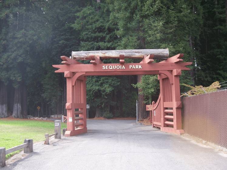
In addition to its popular zoo, garden, and duck pond, Sequoia Park in Eureka, California has several miles of hiking trails. What it does not appear to have, is a map of these trails. There are no maps posted on signs in the park, and no maps to be found online. There are several reasons why a map could be useful. One of the more obvious uses is for recreation. Another use is for access purposes, when maps are available they can aid in planning for disability access, safety, and resource conservation work. This project is intended to be a first step towards providing a map or maps that could be used in these ways.
Sequoia Park is an approximately sixty-seven-acre basin that forms the Headwaters of Martin Slough. According to Wallace and Allen (2007), “Martin Slough is an important rearing area, especially over-winter rearing, for juvenile coho salmon.” Both poor trail alignment and poor trail conditions are associated with increased erosion, which impedes the feeding of juvenile salmonids. According to the National Trails Training Partnership (2007) ” Poorly designed, located, constructed, and maintained trails can cause significant erosion and sedimentation problems. ” Fisheries Biologists have known for years that “Chronic turbidity in streams during emergence and rearing of young anadromous salmonids could affect the numbers and quality of fish produced.” (Sigler, Bjornn, & Everest, 1984). Mapping the trails is a logical first step towards assessing their impacts on water quality in Martin Slough.
Erosion also affects trail quality, making the surface uneven and muddy and exposing roots. Aside from the maintenance problems this can cause, few of the trails appear to be accessible to those with disabilities. There are two paved trails with gradients suitable for wheelchair access. One of these is the Sequoia Creek Trail to the west of the duck pond parking lot, the other is a maintenance road, closed to traffic, that runs generally north-south, behind the zoo. Knowing where to access these trails would be helpful to those who need them the most. There has been a growing interest in facilities that are Americans with Disabilities Act compliant throughout the state. Grants to construct new ADA compliant trails, or modify existing trails to bring them into compliance are available through the California Department of Parks and Recreation Recreational Trails Program’s Office of Grants and Local Services. An assessment of the existing trails would be required to apply for such a grant, and a trail map would facilitate this process.
There has been a recent increase in interest in the parks and open spaces within the city of Eureka, partly due to concerns surrounding the transient population that frequently takes refuge within them. This population has been associated with an increased number of service calls by local agencies such as fire, ambulance, police, etc. Having maps available can decrease response time and allow for a more efficient mobilization of resources.
Although some of the trails appear to have been planned, many of the existing trails appear to be generated by many people taking the same route until a path formed as a result. It appears some of these informal trails, also called social trails have had sporadic maintenance performed on them over the years, either by city staff or volunteers. According to Jeff Marion, author of Guidance for Managing Informal Trails, “The development, deterioration and proliferation of visitor-created informal trails in protected areas can be a vexing management issue for land managers.” Marion goes on to state “The first step should be an inventory of the informal trail network within an area of management concern.” This project was designed to take that step, for all the trails in sequoia park, planned, unplanned, and whatever in between state that the many of them appear to be in so that future projects will be able to use this as a starting point to build upon.
Data Collection Methods
Data was collected over five days, October 3rd through October 7th in approximately three and one-half hour long sessions. A Garmin GPSMap 64 GPS/GLONASS receiver was used to collect the trail data. The device was set in the Setup>Track menu settings to the shortest recording interval to maximize the number of points recorded per track with the intention of increasing accuracy. Data was collected by walking each trail and saving each track individually using the Track Name field to record the type of trail being captured. Waypoints were taken at intersections with side trails to ensure they would not be forgotten and to aid in navigating back to them. Trails were mostly mapped in a clockwise pattern starting at the intersection of Glatt and T Streets. Additional waypoints were taken at other points of interest such as benches, parking areas, fountains, and watercourse crossings. Only well-defined trails that could be walked on were measured, no crawling, sliding or climbing was performed in the collection of this data.
Tracks and waypoints were downloaded to a personal computer after each session using a USB cable and DNR GPS software and saved as shapefiles. The tracks were saved as Multi-Part lines. No post-processing was performed on the GPS data. Line-work was edited in ArcMap 10.4.1 student edition to smooth out some of the odd shapes caused by interference and reflectance.
City of Eureka 2007 Aerial Photography, Parcels, and Humboldt County GIS Roadway Centerlines were downloaded from the Humboldt County GIS Data Download page, and a geodatabase containing CalWater 2.2.1 Hydrography was downloaded from CAL FIRE. The Humboldt County GIS Data and CAL FIRE datasets were all transformed from their native North American Datum 1983 to WGS 84 in order to match the data collected using this geodetic datum with a UTM grid projected coordinate system.
An outline of Sequoia Park was obtained by merging all the City owned parcels adjacent to the trails into a single polygon, which includes the Zoo and adjacent Eureka Parks and Recreation Department facilities. Aerial imaging was used to verify locations and the alignment of the few trails and roads not under a closed canopy. The CalWater 2.2.1 hydro layer was copied and modified to extend some of the tributaries to Marin Slough above the Class II/III breaks, but not to their full extents, which were not measured. The Humboldt County Roadway Centerlines were only slightly modified to remove a segment that does not exist.
In ArcMap, the five shapefiles containing the lines representing trail alignments were copied and renamed for the five classifications of trails. These categories are Paved Roads, Paved Trails, Gravel Trails and Boardwalks, Native Surfaced Trails, and Informal Trails. The individual lines were moved to the appropriate shapefile for each trail type to make symbology easy and consistent. This could also have been achieved by merging and attributing the trail types, but there happened to be 5 shapefiles and 5 categories, so this expedient method was chosen. A similar process was undertaken to sort the waypoints into shapefiles that contained all the same types of features, such as benches and parking areas. The greatest concern with regards to symbology was how to distinguish the line-work, especially the trail types. The paved park roads were a smaller size version of the city streets. The remaining trails used a combination of line size and grayscale to distinguish them. Blue was chosen for the watercourses out of cartographic convention.
To measure the trail lengths an elaborate and inefficient methodology was used. The attribute tables from each of the five shapefiles containing the line-work for each trail category were exported to a folder on a personal computer. The attribute tables were then opened as Excel files, and a new column for length was added to each. The shapefiles were loaded in ArcMap individually and their corresponding attribute tables opened. Each line was selected individually from the attribute table and zoomed to. The line was then measured in feet using the Measure Feature option on the Measure Tool. The length of each line was then manually entered into the Excel table. At this point, it would have been easy to join the excel tables to their corresponding attribute tables, but this was not necessary for this exercise.
Results

Sequoia Park Trail Map
Scale is 1:5000
Approximately six and three-quarters miles of trails were identified and mapped. Of the total, almost half were informal trails. Approximately half of the constructed trails were native surfaced and about half of the remainder were the paved roads that pass through the park. Paved and Gravel or Boardwalk Trails only represented a little under six percent and five percent of the total trail lengths measured respectively. The table below provides a more detailed breakdown of the trail lengths measured.
| Trail Type | Length (feet) | Length (miles) | Percent of Total |
| Informal | 17237.56 | 3.26 | 48.29 |
| Native Surface | 9827.87 | 1.86 | 27.53 |
| Paved Road | 4761.31 | 0.90 | 13.34 |
| Paved Trail | 2107.95 | 0.40 | 5.91 |
| Gravel or Boardwalk | 1758.12 | 0.33 | 4.93 |
| Total | 35692.82 | 6.76 |
Discussion
Sequoia park is clearly a much used and loved resource. Evidence of this was present all over the park. The presence of so many informal trails indicates a desire for more access to all that this park has to offer. Unfortunately, this unplanned network showed several of the downsides to this democratic but thoughtless system of trail creation. Several of the informal trails crossed watercourses or wetlands, a few even ran right up the edge of active channels. Many others had alignments that ran directly down the fall line, one of the most erosion-prone configurations possible.
On a personal note, I learned a few things from this process. I thought, based on prior experience, that this project would be quick and easy. It was not quite as I expected it to be. For one thing, I thought that there would be an easier way to calculate the trail lengths. I assume there is a python script or something that more advanced Arc-users would use, but I am not at that level yet. Another thing I took for granted was the quality of data that I have been accustomed to having access to. DEMs with up to one-meter resolution and LiDAR ground imaging that can show the ground surface through a closed canopy make it easy to correct for minor Error in GPS reception.
This mapping effort represents a good start to what will likely become an iterative process of refining and building upon the data collected. While great care was taken to capture as many of the informal trails as possible, a few undoubtedly slipped through the cracks. Trail alignments would benefit from further fine tuning, as would the mapping of the tributary watercourses. Once the quantitative details have been worked out, maps could be published and more qualitative assessments could then take place.
References
Wallace, M., & Allen, S. (2007). Juvenile salmonid use of the tidal portions of selected tributaries to Humboldt Bay, California. Final Report for California Department of Fish and Game Contract P, 410504.
National Trails Training Partnership (2007). Trails Design and Construction. Retrieved from http://www.americantrails.org/resources/trailbuilding/NHerosioncontrol.html
Sigler, J. W., & Bjornn, T. C. & Everest, F. H. (1984) Effects of Chronic Turbidity on Density and Growth of Steelheads and Coho Salmon, Transactions of the American Fisheries Society, 113:2, 142-150, DOI: 10.1577/1548-8659(1984)113<142:EOCTOD>2.0.CO;2
Guidance for Managing Informal Trails (Draft) by Jeff Marion, Virginia Tech Retrieved from http://www.parks.ca.gov/pages/1324/files/trail%20management%20guidance.pdf

That is a really wonderful project. It was mentioned to me by mutual friend Jeanne Marie.
LikeLike